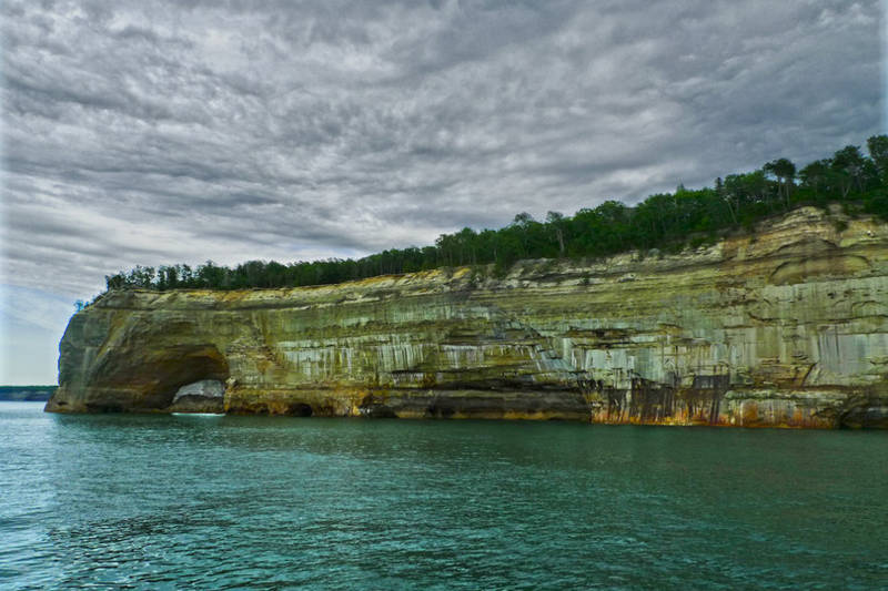
This arch formation to the left is called Lover’s Leap. It’s part of Michigan’s Pictured Rock national shoreline.
2 Responses to “lover’s leap”
1
Celeste:
I wonder…do they? How long is the pictured rock shoreline? The colors are interesting.
Good shot. Where were you when you took this and what time of day was it?
July 5th, 2010 at 12:27 pm
2
Michael McGuire:
The Pictured Rocks is about a 40 mile stretch along the southern Lake Superior shoreline between Munising and Grand Marais. It was beautiful. The next time I visit, I want to kayak. That would be amazing. We took these shots from the tour boat that goes out of Munising. It was early evening. The dynamic range of the image was high and the rocks were underexposed compared to the sky. A little post-process tweaking brought out the colors and the highlights in the sky.
I wonder…do they? How long is the pictured rock shoreline? The colors are interesting.
Good shot. Where were you when you took this and what time of day was it?
The Pictured Rocks is about a 40 mile stretch along the southern Lake Superior shoreline between Munising and Grand Marais. It was beautiful. The next time I visit, I want to kayak. That would be amazing. We took these shots from the tour boat that goes out of Munising. It was early evening. The dynamic range of the image was high and the rocks were underexposed compared to the sky. A little post-process tweaking brought out the colors and the highlights in the sky.